Collections Online
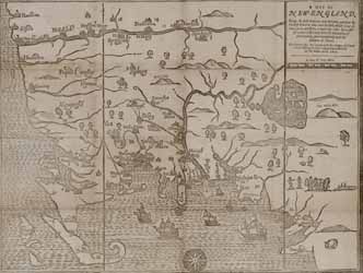
A Map of New-England
Image 1 of 1
To order an image, navigate to the full
display and click "request this image"
on the blue toolbar.
-
Choose an alternate description of this item written for these projects:
- Witness to America's Past
- MHS 225th Anniversary
- Main description
[ This description is from the project: MHS Collecting History ]
The first map engraved and printed in British North America is attributed to John Foster, a mathemetician and schoolmaster, who was the first printer in Boston. The map originally appeared in William Hubbard's A Narrative of the Troubles with the Indians in New-England, the best early account of the Indian Wars published in America.
There are more than 5,000 historical maps and charts in the Society's collections as well as early printed books illustrated with maps.
Provenance: Gift of Robert C. Winthrop, Jr., 1895.

